Several sites including Strava and Veloviewer provide heat maps and data for all the places you’ve ridden (or run). My favorite- and one of the best known- is Wandrer.earth (See DC Rainmaker’s review of the site here).
In their own words- “Wandrer is meant to encourage you to take a small action against going where you’d normally go. There are many places out there worth seeing for their own sake. To find new parks, to see how your neighbors live, to eat at new restaurants, and to be some place new and unfamiliar in your own city.”
Wandrer lets you toggle on roads you’ve never ridden and roads you have ridden on a Big Map. With personal progress and leaderboards, it motivates you to ride places you’ve never ridden before.
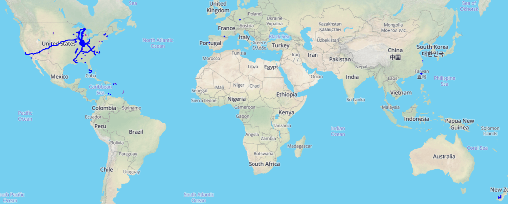
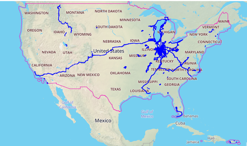
Here’s my own Big Map (as of February 2022- it’s always changing!) It’s US dominated, but also neat to see all the places I’ve ridden, including Taiwan and China, the Caribbean, and New Zealand:
Wandrer uses Strava data to populate your map. But since many of us have been riding since long before Strava and GPS cycling computers existed- how to see all the places you’ve ridden? I discovered a workaround.
Start by creating a map of your past ride on RidewithGPS or other site, and download a .gpx file. Then use this utility to create timestamps to simulate your route as an actual ride: https://gotoes.org/gotoes/strava/ It’s a free site, but you will get prompted to make a donation. I definitely advocate donating if you use it more than once or twice. Software developers have to eat too 🙂
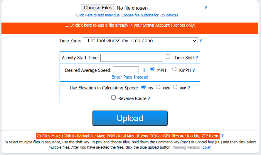
Upload the .gpx file you created, and go through the prompts to add the date of your actual ride, estimated pace, and more:
Once that’s done, you will get a FIT file to download that simulates your ride as if you have the actual GPS track. You can also use this approach in the event of a GPS device failure. Then go back to Strava and click on manual upload (+ in upper right of the Strava main page):
Select Upload Activity from the + menu and then file (note that you can upload multiple files at once):
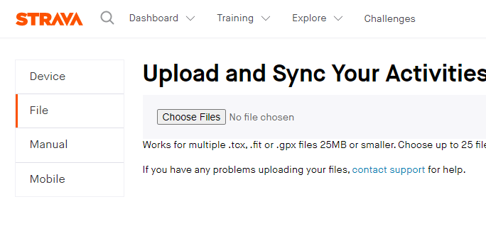
Navigate to where you saved the downloaded FIT file from the Gotoes utility. Upload and then edit the ride name and details as you would with any other Strava activity.
I always set these activities in Strava to Private. Yes I did the ride, but it’s not the actual data (the dates might even be approximate), and it’s only for my use (though it will be public on Wandrer). But that’s me.
Wandrer will then pick up these old activities- click on your account, then Settlings, and “check for activites”. NOTE: you must be a paid Wandrer user AND must upgrade to paid user before importing old activities to get them to appear.
This does create something of a quandary- is this “cheating”? I say it’s not because I actually did the ride. Does it matter? It does affect Wandrer leaderboards, so some might feel like it’s misleading, which is understandable. I use this approach so I can see lifetime progress of my cycling.
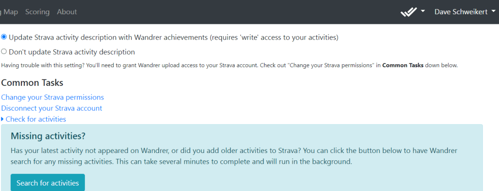
You can also allow Wandrer to post your # of new miles in your Strava activity (the radio button in the top of this screenshot).
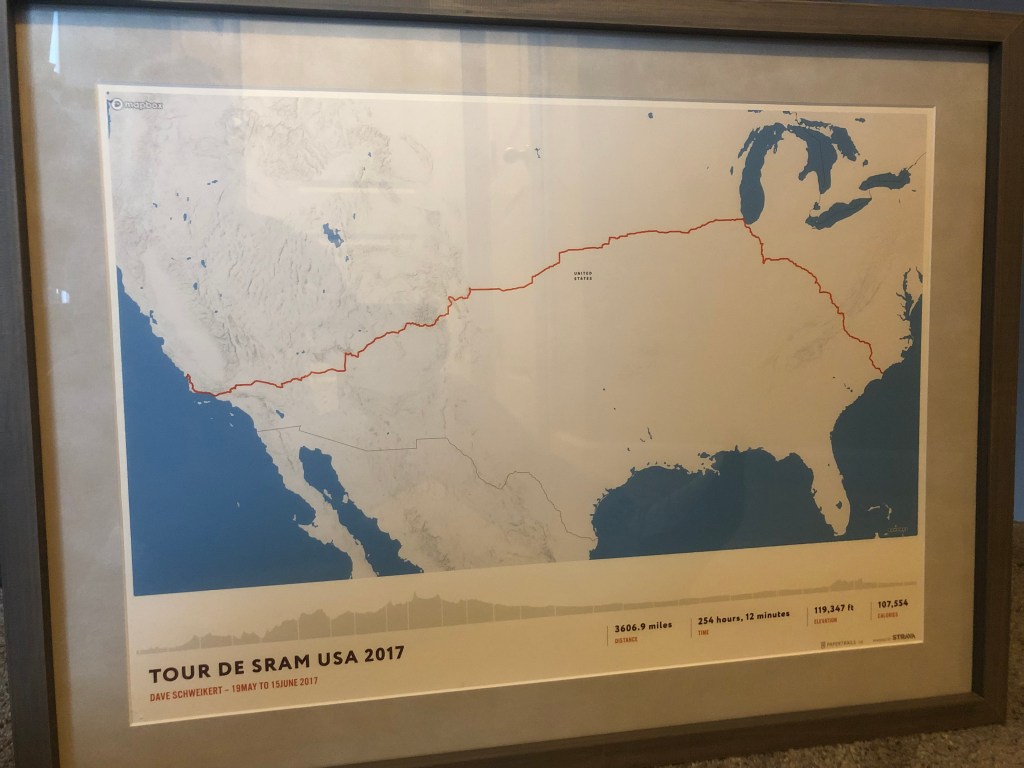
If you want to display where you’ve ridden- or otherwise use your Strava data- check out the Apps under the Explore menu on Strava. My favorite is https://papertrails.io/

Hanging in my cycling/workout room is a Paper Trails map of my ride across the US:
Bonus tip: here’s a great site for fixing ride files- say you left your Garmin on, have corrupted data (I once had a heart rate monitor show my heart rate at over 180bpm continuously for a 200 mile ride!), and more- FIT File Tools. The Gotoes utility has some of these also.
