Planning and preparing to plan across America was my primary focus for nearly a year. Unless you’re using a predefined route such as the US Bicycle Route System, an Adventure Cycling route, or similar (or you’re extremely flexible), my experience is that route planning is generally the largest time commitment when preparing for a long endurance ride.
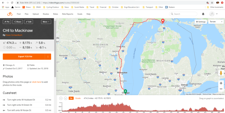
Ridewithgps.com sets the standard as the tool for planning routes (free, but downloading routes to a GPS device requires premium membership- well worth it.) See the Where I’ve Ridden page for details on Wandrer.earth– I always use the Wandrer Chrome plug-in to ride roads I’ve never ridden. Go explore new places!
Here are a few other notable sites for mapping rides:
- Komoot, which has the added advantage of showing road surface type (which now RidewithGPS does also)
- For researching climbs all over the world- I use PJAMM Cycling– (check out my contribution here!)
- More of “the road less traveled”: America’s Quietest Routes
- Gravel roads: Gravel Map; my favorite- the gravel roundabout of course!
- Bikemaps– global site for safe cycling routes
As I plan a route, I toggle between RwGPS and Google Maps Streetview to select roads and see if I consider it rideable. Paved county roads that parallel interstates or state highways are the best when I can find them for sufficient distances. I also switch modes between Driving and Cycling (and even Walking in cities). It is not an exact science. I may start with my start and end points for each day if I already know what they are, then go mile by mile looking at road sections, zooming out periodically to make sure I’m not zigzagging too much.
After I’ve mapped the entire route, I’ll break it into sections of 200-300 miles to keep the files from getting too large before I download to my Garmin.
Most of my rides are focused on getting between point A and point B (or points A, B, C, and D) as quickly as possible. There is always a balance of finding bike-able roads that are as direct as possible, which can present a challenge. I avoid gravel roads since they’re generally slower, especially on descents, but also ride 30-32mm tires to be prepared for unexpected gravel and rough surfaces if needed.
One of the lessons I learned from riding across the US was that adding a few extra miles on good riding roads is far preferable to choosing shorter distance but poor roads. I lost out on the fun of descents- and probably cost myself time in the long run- on gravel farm roads simply because I had chosen the shortest possible route.
Bike paths are normally avoided: often curvy and crowded with frequent stops make them great for family rides but not for covering distance quickly. There are exceptions, especially long distance rail-trails such as the Cardinal Greenway in east central Indiana. Paved, low traffic, fewer cross-street stops and restrooms make it a great option. In big cities, bike paths are often the best option. The Prairie Path into Chicago from the west suburbs might have saved my life to get away from traffic. Here’s a view of it, along with the Little Miami Scenic Trail outside Xenia, Ohio, both of them exceptions to the “no trails” rule.


Many roads that Google shows as bike friendly- or as roads at all- are not. “Google Maps is not your friend” is one of my cycling phrases. I’ve nearly gotten wet when Google Maps showed a bridge across a creek or river that in reality did not exist. Brake hard! Turn around! Look for alternate route (see “phone” on packing list below). To avoid this requires tedious mile by mile on-line scouting of the route.
Despite my snarkiness, Google Maps Streetview is a huge, huge help to get an idea of road type, conditions, shoulders, etc. My first attempt at a cycling route across America put me onto single-track mountain bike trails in the Mojave Desert. Other times, even “bike routes” have been on busy state highways with no shoulder.
4-lane roads vary- some are definitely not rideable, heavy traffic with only a gravel or no shoulder at all.


But as an example, US31 in Indiana, while not scenic, has a smooth, wide shoulder separated by rumble strips- definitely rideable:

Having a little improvisation and flexibility is good. Wasting time plotting and then trying to follow a route on my phone- instead of actually riding- is not.
There are many resources from bike clubs, state transportation departments, and cycling organizations, especially the Adventure Cycling Association, which provide cyclists valuable input on recommended roads and routes to ride- or to avoid. I got some great tips after posting my plan on the ACA Forums.
Some states have maps that show road surface (eg gravel) and average daily traffic counts, which can be a great starting point before using RwGPS for creating a detailed route. Here’s a link to a page where I have started to list some:
https://whyiride.org/us-state-bike-maps/
You can also search existing routes on RwGPS, though it can consume a ton of time to sort through them. Contacting local bike clubs is another option, although it hasn’t proven very useful for me.
Lastly, I always keep an eye out for scenic stops along the way even when I’m covering as many miles as possible. The most notable was riding across America, when at one person’s suggestion, I added ~50 miles in order to bicycle through the Grand Canyon and 4 Corners. Those were both unbelievable! Other times, even a short detour or picking an alternative route, enabled views such as these:


Overnight stops
Though common for bike touring and long-distance cyclists, camping is not a realistic option for my style of long endurance rides. The time required to set up and break camp, cook, and additional weight of supplies don’t allow for it. The upside is I travel light and fast. The downside is that finding overnight stops is crucial. I can’t just stop when I’m tired and want to.
So credit card touring it is. I usually stay at budget, often family run, non-chain hotels that I find on Google Maps or booking.com (read my blog entries from TDSU17 for Colorado and W. Virginia for a couple fun stories). I also stay at chain hotels occasionally and use Warmshowers when I can. Prior to my departure, I try to have a couple options saved on my phone, in the vicinity of where I plan to stop each night to avoid spending time searching for hotels in the middle of a long day’s ride.
Preparing ahead of time is not always possible. When I rode along with Mark Beaumont, I had no idea where I’d intersect him or end up for the day. I had to play it by ear. In the dark about 9pm. After riding 200 miles for the day already. As Mark turned north, I needed to head back east and south. I pulled off and pulled out my phone. A few minutes in that case was all it took to find an available Hampton Inn about 15 miles away (using hotel points no less!)
With Warmshowers, I have to keep in mind that I’m a guest. I can’t show up at 9pm, expect a couple meals (dinner and breakfast) and a bed, and leave at 6am. For those amenities, the hosts in return get social time and storytelling with their bike touring guests, which 100% of the time has been a blast (and I’m an introvert by nature). I even still keep in touch with a couple of my Warmshowers hosts. But there is a time commitment of at least a few hours per night to reciprocate the hospitality shown to the bike tourists.
The hardest part of determining overnight stops, even in populated areas, is how far I’ll ride each day. When I rode across America, limited options in the western US (where towns could be 50 miles apart) forced me to plan the first dozen nights of the trip before I started. There were a few days when I wished I could have ridden longer. But if I had, my schedule would have been blown up. And vice versa, there were times I was ready to stop but had no choice but to push on to my planned nightly destination. So the task became “ride to distance”, not “ride to time”- which is possible in more populated areas or if camping.
Determining how far to ride each day has to take into account factors like distance, weather, winds, fatigue, and climbing, not to mention unforeseen issues. Most bike touring and bikepacking sites will say go slower and enjoy the scenery. That fits for most people and in many cases, but not on long endurance rides. So a lot of thought, planning, and math goes into considering the variables and calculating the best place to stop each night.
Finally, if all doesn’t go according to plan, for emergencies I do carry a bivvy sack. It is smaller than a can of soup, weighs only a few ounces, and provides peace of mind if it becomes necessary. The bivvy is still in its original packaging, thankfully!
Most of this applies to road touring. Even if I ran into problems, there are cars and people around even in the middle of the night, so getting into trouble in the middle of nowhere is- relatively speaking- not a significant worry. Bikepacking and riding mountain bikes into wilderness areas is entirely different and frankly presents considerations for both eating and sleeping that I haven’t tackled (yet?) If that’s your interest, I’d start with http://www.bikepacking.com for planning advice (and inspiration).
Long distance self-supported racing is definitely now “a thing”. Here are a few of the best known:
Trans Continental race- Europe
Trans Iberia race- Iberian peninsula
Trans Am bike race- across America
These are not much different than what I do solo, since camping isn’t practical for a race. However, I do stage supplies for any ride longer than a couple days. On the ride across the US, my wife mailed supplies to me along the way, so they arrived 2-3 days ahead of me.
The races do not allow outside support of any kind- you must be entirely self-supported. Staging supplies- mailing my on-the-bike food- ahead is key for me. I want to control what I eat while riding as much as possible. Plus that saves time searching convenience stores- I only do that for water and sometimes for dinner. Staging supplies is easy- just mail ahead to Warmshowers hosts or hotels, or hold for pick up at post offices.
Now that the route is planned, next is Packing.
